Thursday, May 31, 2012

Looks like I've finally gotten to the end of my photos from my trip southward.  These are from Mississippi, the last state we went through before heading home.

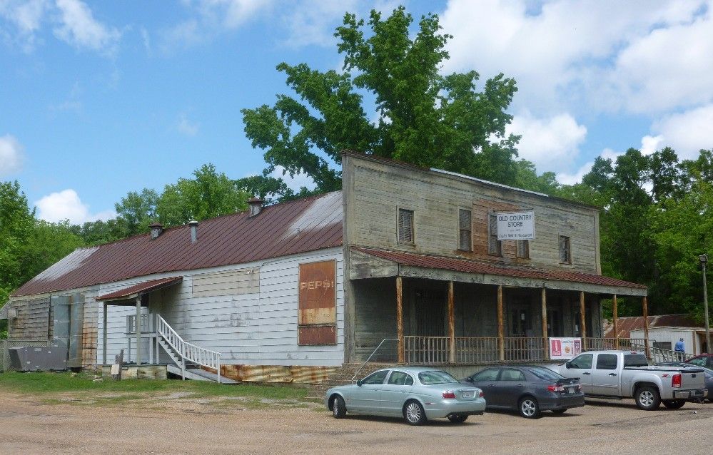
On US highway 61, just north of Lorman, is the Lorman Country Store, which sells many kinds of antiques and memorabilia, and offers a buffet lunch.  If you like to stuff yourself with some good old Southern-style food, this is the place to go.

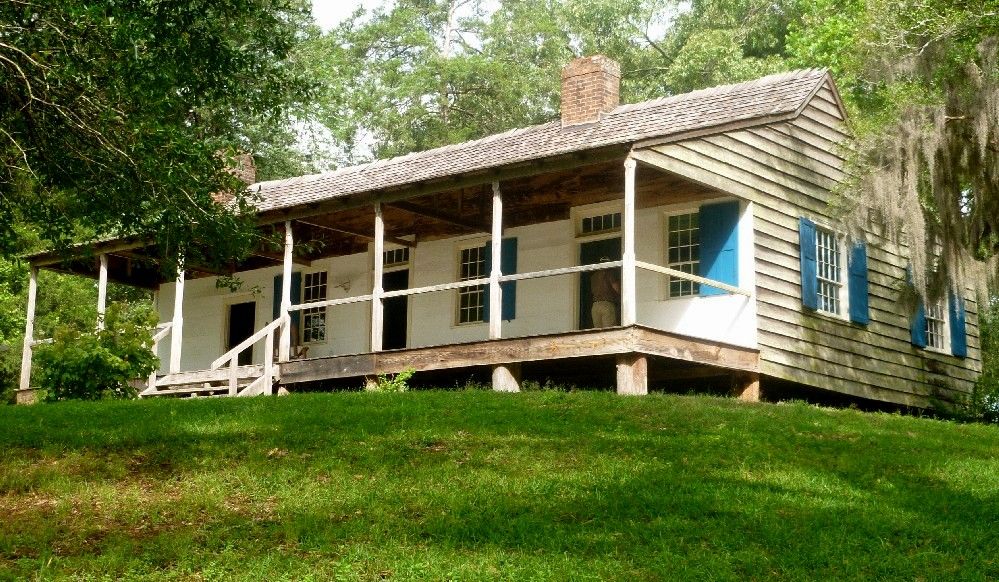
To the east of Lorman is an old run-down house that was the center of a plantation known as Prospect Hill.  Some of the slaves at Prospect Hill were allowed to go to Africa to help establish what would become the country of Liberia.  Their story is recounted by author Alan Huffman in the book Mississippi In Africa.  This is one side of the house.

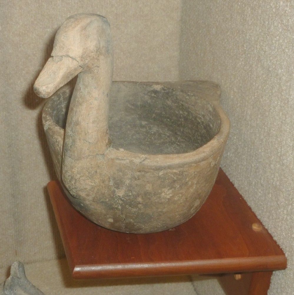
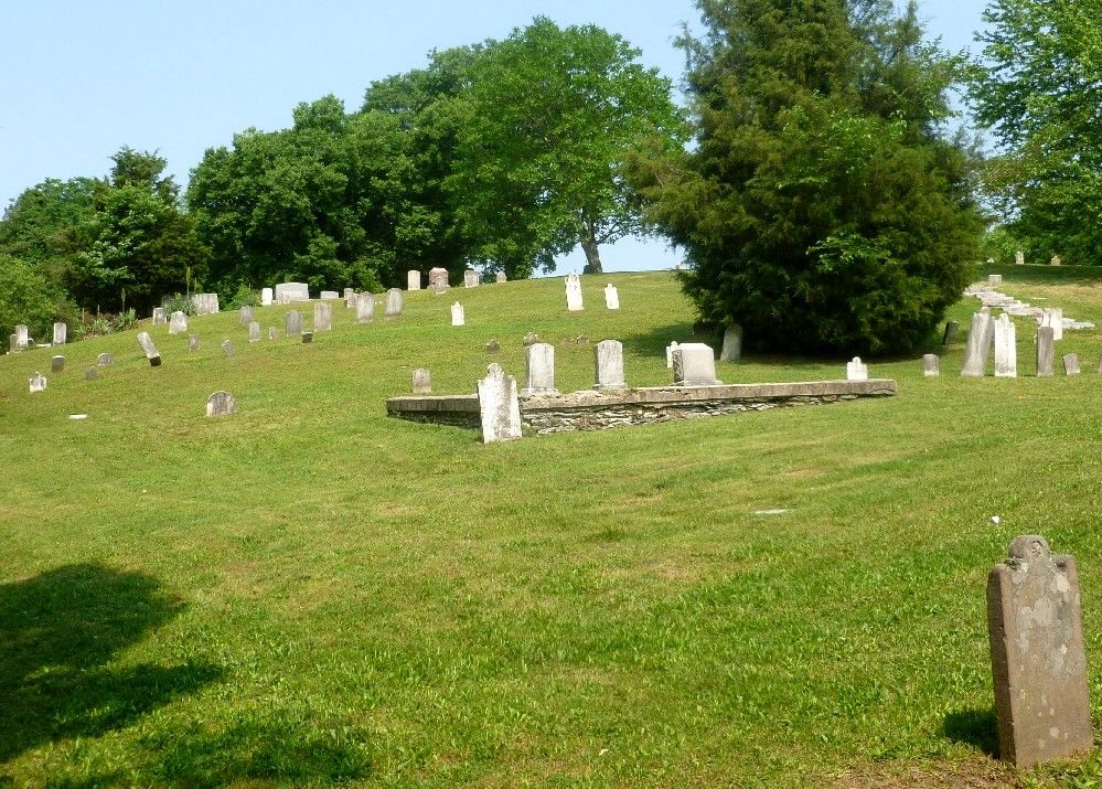
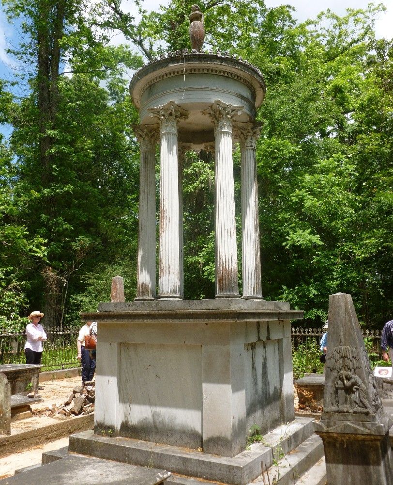
The interior of the house is also in bad condition.  The basement is full of worn-out junk, including three ruined pianos, with a fourth on the main floor.  Behind the house is a small graveyard, including this monument.

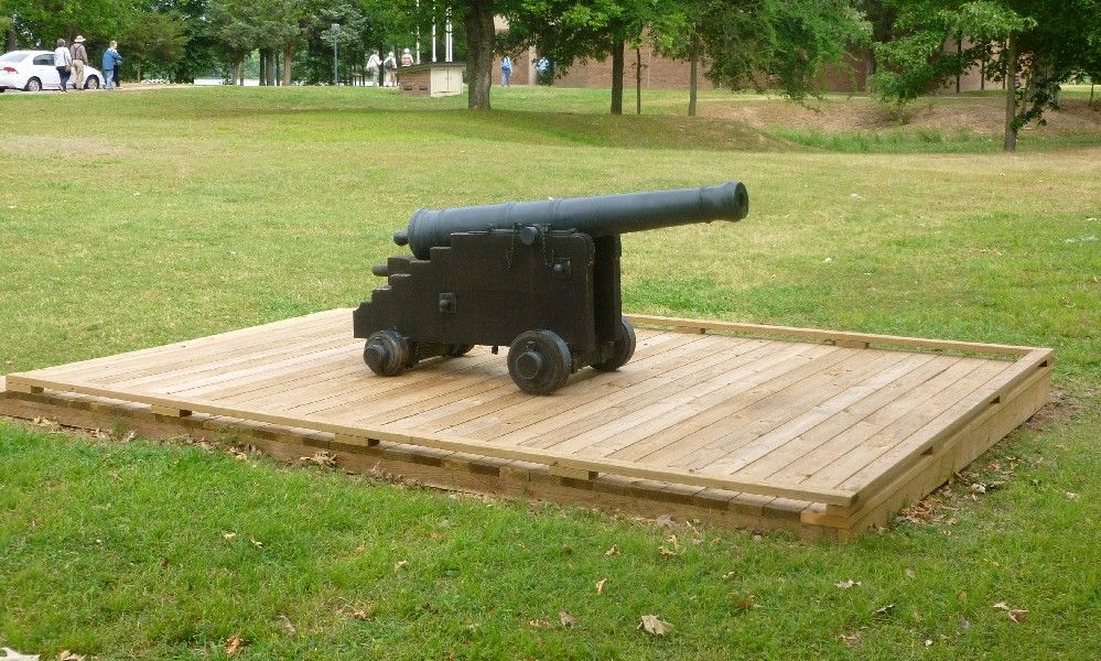
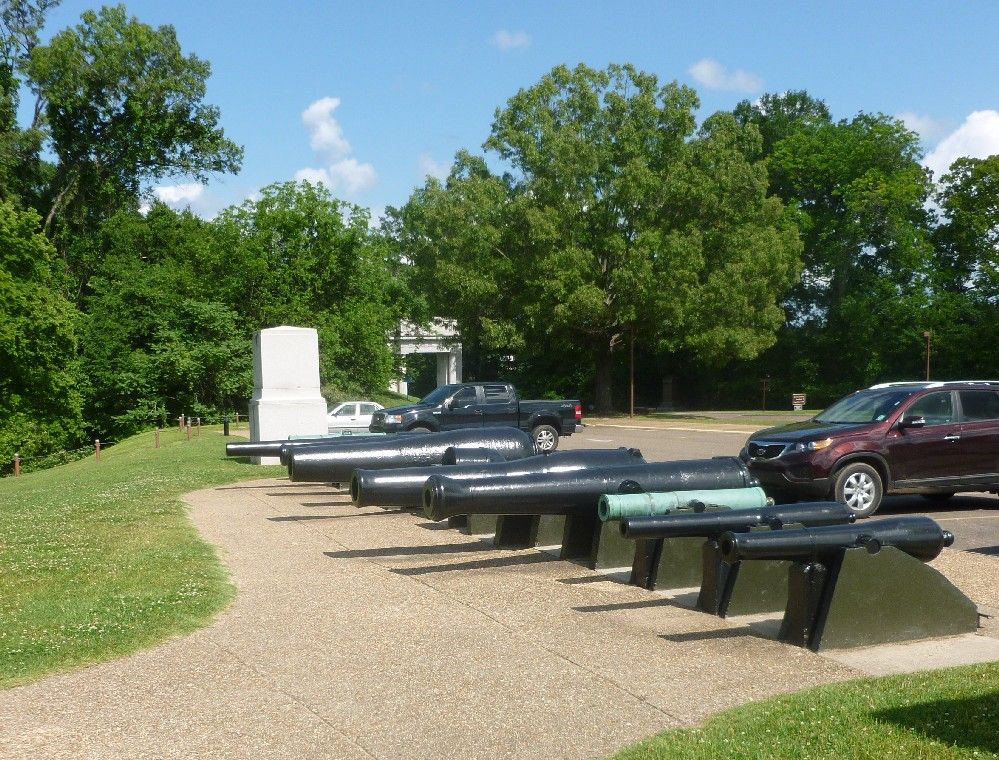
After leaving the Lorman area, we went up to Vicksburg, known for being taken by Union forces during the Civil War, after a long siege.  The outskirts of the city, where most of the fighting occured, are now preserved as a National Military Park, which is strewn with monuments to the soldiers who fought there.  Like other prominent Civil War battlefields, the monuments are mainly identified with each state that was represented in the battle.  There was no opportunity to take pictures of most of the monuments, but before we went into the park, I found this row of cannons next to a parking lot.

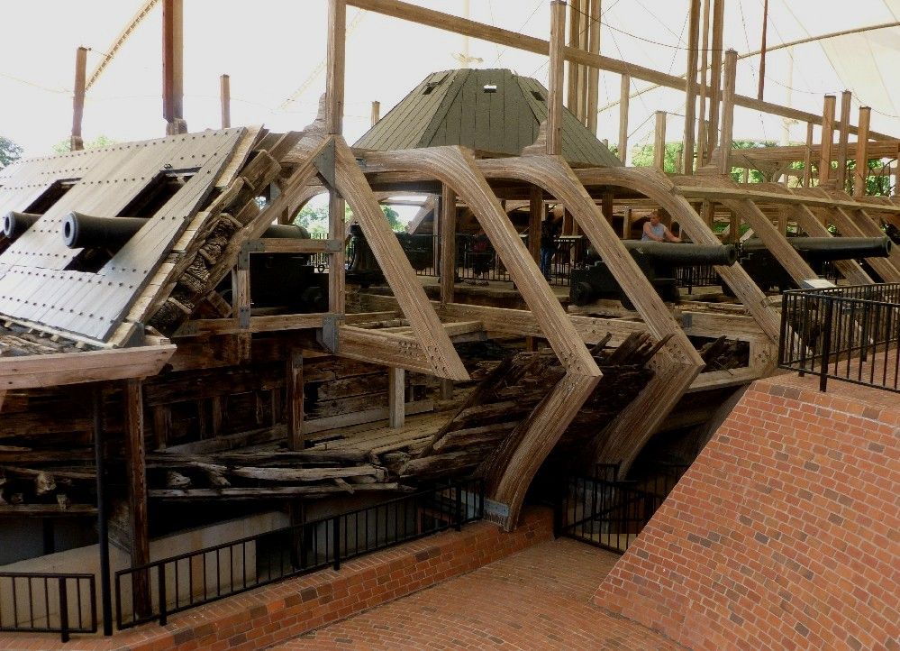
Vicksburg Military Park includes the remains of the USS Cairo, one of the earliest ironclad ships.  The outer frame of the ship is a modern reconstruction, but much what is seen here was preserved in Mississippi River mud for about a century before being taken out.  Here's a front view.

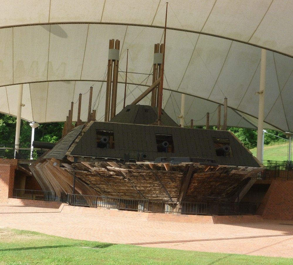
The ship can be accessed by a walkway, which is just behind the man standing next to a cannon.

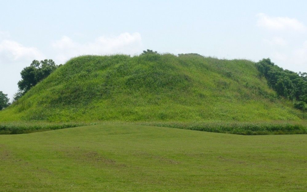
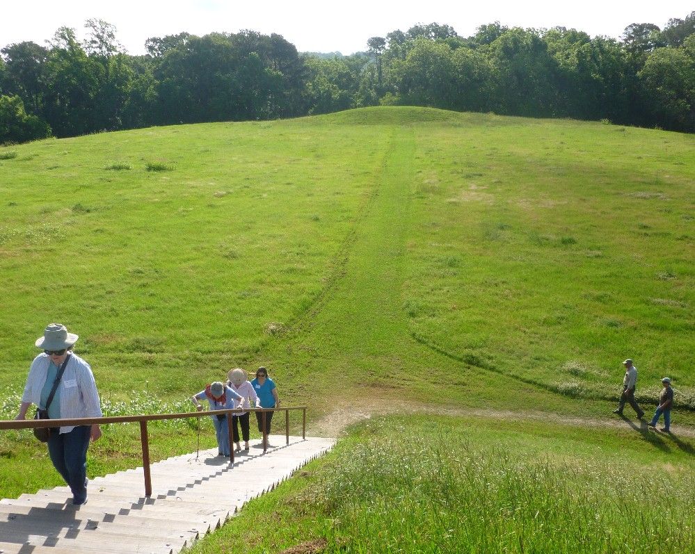
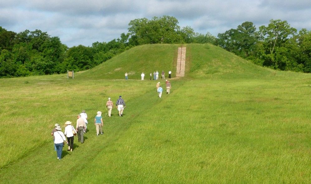
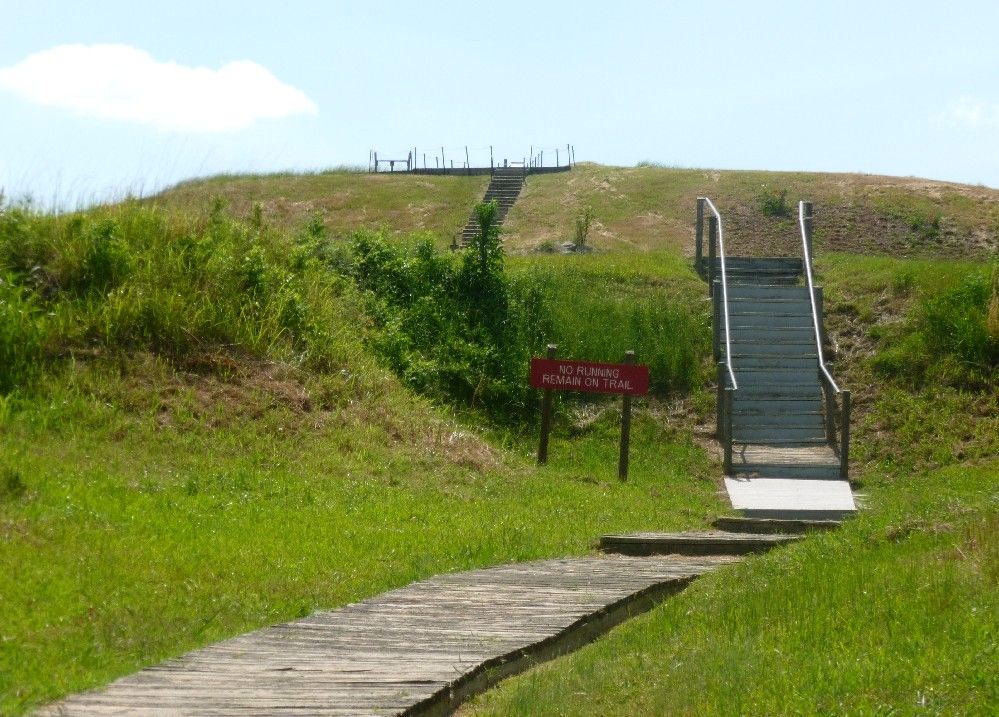
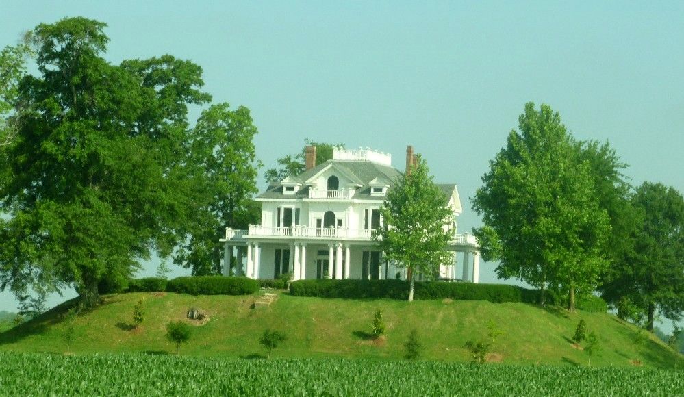
North of Vickburg, near Rolling Fork, is the house known as Mont Helena.  It was built in 1896 atop an Indian mound.  Today, it is used as a theater, and is also open for tours, which may come with a lunch or dinner.

In downtown Clarksdale is the Ground Zero Blues Club, a restaurant and music joint owned in part by the actor Morgan Freeman.  The area north of Vickburg and between the Mississippi and Yazoo Rivers is known as the Mississippi Delta, and is widely recognized for the style of blues music that originated there.

Yes, those are couches on the front porch.  Inside, customers are allowed to write on the walls.  In fact, it was hard to find a place for my own small contribution.

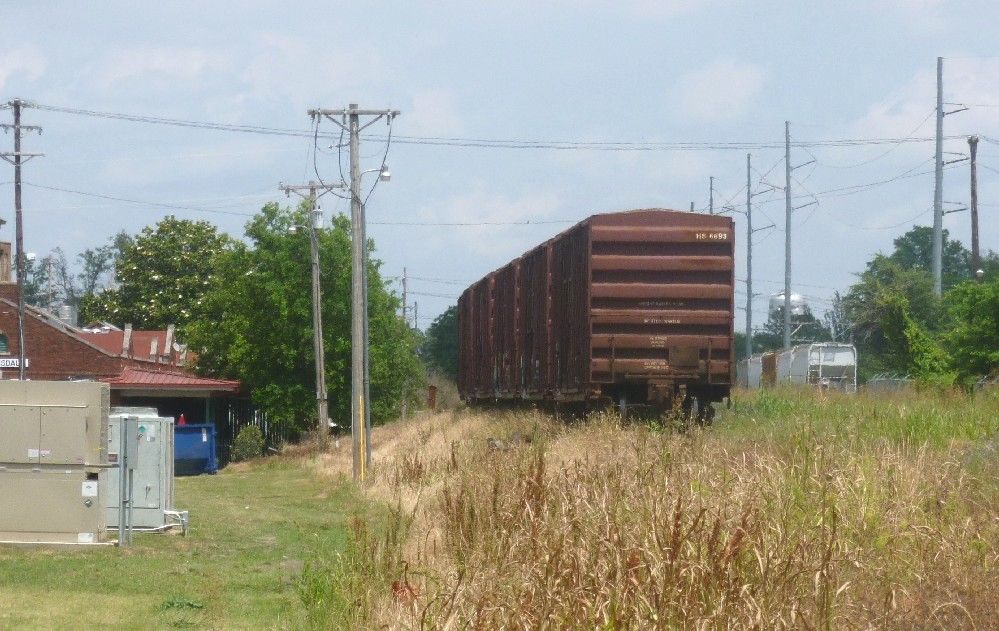
Finally, just beside Ground Zero are the railroad tracks, with a few parked railcars.

Wednesday, May 30, 2012

I still have some unposted pictures from my trip to the deep south, about half from Arkansas and the rest from Mississippi.  Thus, I'll group them into two posts, one for each state.

Near Parkin, Arkansas are the remains of a fortified Indian settlement known as Casqui, which are now preserved as a State Park.  While travelling around what is now the southern United States, Spanish explorer Hernando de Soto came upon this place and met its leader, who was also named Casqui.  At the time, Casqui and his people were in the middle of longstanding war against a somewhat larger group of Indians led by a chief named Pacaha.  Like Casqui, Pacaha lived in a fortified town, and also ruled over several smaller villages.  As he had done with Casqui, de Soto spent some time in Pacaha's main settlement.

Today, this sign marks the entrance to the park:

During his visit to Casqui, de Soto and his men raised a cross, possibly on this mound.  Behind it is the St. Francis River, which served as a transportation route for Casqui's people.  Part of the river was diverted into a ditch to create a moat around the Casqui settlement.

The Hampson Museum in Wilson, Arkansas is likewise a State Park.  Behind this sign are railroad tracks and a section of US highway 61 running parallel thereto, and which is named after football player and Arkansas native Cortez Kennedy.  The University of Arkansas has created a Virtual Hampson Museum.

It's a little tricky taking pictures of exhibits behind glass, but I think I did okay with these two shots.  This is an three-headed effigy pot.  Two heads are clearly visible, with the third behind the head on the left.

This other one I'll just call AFLACK!

Tuesday, May 29, 2012

During the ceremony to present the Medal of Freedom to (among others) the late Georgetown professor Jan Karski, who had been involved in the Polish resistance to Nazi occupation during World War II, President Obama used the term "Polish death camp".  This choice of words was hardly noticed by most Americans, but over in Poland, shall we say, gniewajÄ… siÄ™ bardzo.  (They're really pissed.)  As some in Poland have pointed out, the death camps were not Polish, but were established by the occupying Germans.

Read the story at the Buzzfeed.

Full disclosure:  By ancestry, I'm 1/4 Polish.  I have some knowledge of the Polish language, but not enough to effectively translate the quotes in the Buzzfeed article.  I have visited Auschwitz, including the Birkenau unit, which are in and around the Polish town of OÅ›wiÄ™cim.  A few years back, Obama said that his uncle was in an American brigade that liberated Auschwitz, which is impossible because in reality Auschwitz was taken from the Germans by the Soviet army.  He later corrected himself and said that it was Buchenwald.

Monday, May 28, 2012

Two rivers meet at Harper's Ferry, and so do two railroad lines.  One of them proceeds southward, running along the Shenandoah, and is supported by a wooden tressel.  From the river, you can see the tressel and some buildings including St. Peter's Catholic Church.

As I mentioned in Part 1, the Appalachian Trail runs through Harper's Ferry.  Proceeding southward (and up some 18th-century stone stairs) from the railroad bridge over the Potomac, the trail runs right beside St. Peter's.  Here's the front of St. Peter's, which is said to be haunted.

Further up the hill are the ruins of St. John's Episcopal Church.  This church building was abandoned in 1895, when the congregation moved to another location within the city.

After the ruins of St. John's, the trail continues through a wooded area.  A short side trail, which is mostly a stairway, leads up to Harper Cemetery.

Not far from the St. John's ruins is Jefferson Rock, so named because Thomas Jefferson took in the view of the valley below while standing near it, on a visit to Harper's Ferry in 1783.
The topmost rock was originally freestanding.  The red pillars, made of sandstone, were put in place around 1860.

While researching Jefferson Rock, I stumbled upon a site that has pictures of Harper's Ferry from around 1970.  The site's name is Moosic Mtn. Wild, which I find interesting since Moosic Mountain (which includes a nature preserve) and a small town named Moosic are located in northeastern Pennsylvania, about 250 miles to the north of Harper's Ferry.
...is not what the government or the people owe to our respective monetary creditors, but what we owe to those who made the ultimate sacrifice to keep us free.  At least two political cartoonists have understood this truth.

From Nate Beeler via All Voices:

From Karl Wimer via Toonpool:

We incur this debt because, as related in a familiar poem, it is the soldier who gives us our freedoms.
I still have some mound-related pictures from my recent trip to the South.  One of the last places we visited was Winterville Mounds, a few miles north of Greenville, Mississippi.  While registered on the National Register of Historic Places, the site is maintained by the Mississippi Department of Archives and History.

This the western side of the largest Winterville mound, with a smaller mound in front of it.

The eastern side includes a walkway to the top.

Ready for some exercise?  Here ya go!

I think that will be enough mounds for a while, but I have some other photos from the trip.  Fortunately, there were other types of places that were included in the trip.

Sunday, May 27, 2012

One nice thing about living in Maryland is the proximity to lots of historic places.  One of them is just across the Potomac River in West Virginia.  Harper's Ferry is known for John Brown's raid on the federal armory in 1859, but over 50 years earlier had been visited by Meriwether Lewis to obtain weapons and other supplies for his (and William Clark's) expedition to the west.

As Brown's raid deteriorated into failure, he and some of his men took refuge in the armory's small fire engine house, which would eventually become known as John Brown's Fort.  It has been moved from its original location, but today sits next to the intersection of Potomac and Shenandoah Streets.


On the other side of John Brown's Fort was a historical exhibition.


The Maryland side of the Potomac can be reached by a walkway attached to this railroad bridge.  The walkway is part of the Appalachian Trail, which runs through Harper's Ferry.

On the Maryland side is the Chesapeake and Ohio Canal towpath, which extends from Washington, DC to Cumberland, Maryland.  The canal (or more precisely, what's left of it) and towpath form a National Historic Park.  Near the Maryland end of the above bridge is the remains of one of the locks.

Here's part of Harper's Ferry as seen from the Maryland side.

Saturday, May 26, 2012

Just one song this time.  All the recent controversy over Senatorial candidate Elizabeth Warren (D-Mass), who may or may not be 1/32 Cherokee, has reminded me of this number from way back, by Paul Revere and the Raiders.

Friday, May 25, 2012

As the Memorial Day weekend gets underway, here are a few things I've run across today:

The Wall Street Journal notes that the Dow has had only 4 "up" days this month.  The last month with this few occurred over a century ago.  (There are still a days left in May, so this dubious distinction could still be avoided.)

The Jerusalem Post reports that Syrian troops have killed over 50 people in an attack on the town of Houla, including 13 children.

From Fox News, the Obama administration prepares a plan to vet some Syrian rebels so that they may receive arms from Arab nations.

From Breitbart's Big Government comes a biographical sketch about Senatorial candidate Ted Cruz (R-Texas), who has gained some support from the Tea Party movement.

Conservative Daily News reports on the dangerous tactics of "Speedway Bomber" Brett Kimberlin.  Who is Brett Kimberlin?  I confess that until today, I had never heard of him, but from what I gather, he doesn't like conservative bloggers.  StixBlog gives us some more information.

From Expose Obama, Democrats call Arkansas voters "racist" in response to the president's narrow primary victory in that state.

From the Mercury, mosquitos carrying the West Nile virus have been found in Pottstown, Pa.

From Boston.com, the privately-funded unmanned Dragon spacecraft has arrived at the International Space Station.  I'm sure that wherever she is, Anne McCaffrey is pleased.

From the USA Today, UN inspectors in Iran have found evidence that some uranium has been enriched to a greater degree than previously thought.

From SFGate, the German city of Hamelin once again has a problem with rats.

From MSNBC, a backyard party in Boxford, Massachusetts was crashed by beer-drinking cows.

And last but not least, in the Daily Jeffersonian, guest columnist Dan Speedy gives his thoughts on Memorial Day.

Tuesday, May 22, 2012

Located northeast of Natchez, Mississippi along the Natchez Trace Parkway, Emerald Mound is the second largest prehistoric earthwork in the United States.  The Mississippian ancestors of the historically-known Natchez Indians reshaped a natural hill into a platform having angled sides and a flat top almost 8 acres in area, and then built smaller "secondary" mounds atop the main mound.  Two of these remain, at its opposite ends.  Here's the view from the larger secondary mound to the smaller one, across the platform.


Down at the other end, atop the smaller secondary mound, looking back at the larger one.

This is a side view of the larger secondary mound.  Although this mound dwarfs the people standing on it or using the modern stairway, it's still tiny compared to the primary mound on which it sits.

Monday, May 21, 2012

The first European settlement in what is now the state of Arkansas was a trading post created by French explorer Henri de Tonti, was later occupied by the Spanish, and would eventually become the first capitol of Arkansas.  The location of the post shifted over the years in response to flooding from the Arkansas River.  Today, the Arkansas Post National Memorial preserves the post's most recent location, where it served as a river port after the area had been acquired by the United States as part of the Louisiana Purchase.

The French had been able to get along well with the neighboring Quapaw Indians.  After the French and Indian War, the French turned the area over to the Spanish, who likewise became friendly with the Quapaw.  During the American Revolution, the Spanish and Quapaw fought off an incursion by the British and their Chickasaw allies, which became known as the Colbert Raid.  The Confederate army built Fort Hindman near the post in 1862, during the Civil War.  Union forces destroyed the fort a year later, thus gaining control over the lower part of the Arkansas River.

During its time as a river port and territorial capitol, the Arkansas post grew into a small town, which included this cistern.

The post includes this cross, with an oxbow lake in the background.

Driving into the parking lot, you'll see this cannon.

If you hang around for a while, you might get to see some local residents.
That was my reaction to the decision by San Francisco Mayor Edwin M. Lee to rename a street after former House Speaker Nancy Pelosi.  From CBS San Francisco:
The road was formerly known as Middle Drive East, and runs past the back of the California Academy of Sciences and past the Aids Memorial Grove. Nancy Pelosi Drive connects Martin Luther King Jr. Drive with John F. Kennedy Drive.
For a second there, I thought it said "Middle East Drive".  Also reporting on Nancy Pelosi Drive are the Los Angeles Times and the Washington Examiner.  To give proper credit, I must acknowledge that the title of this post comes from the former Speaker herself.

Sunday, May 20, 2012

Singer and musician Robin Gibb, after a long battle with cancer, died earlier today in London.  With his brothers Barry and Maurice (who died in 2003), he had formed the Bee Gees, who became one of the most successful acts in popular music history.  They performed mainly ballads and soft rock during the late 60's and early 70's, but then caught the disco wave, culminating with their contributions to the soundtrack for the movie Saturday Night Fever.  While Barry was the most frequent lead vocalist of the trio, Robin sang the lead on some of their more popular songs, such as Massachusetts.

Saturday, May 19, 2012

So asks the writer of a letter to the editor of a small newspaper in Michigan.  Via a12iggymom.
Like a12iggymom, I found myself wondering, "Where's Tawas City?"  As it turns out, it's on Lake Huron, north of Saginaw Bay, and has its own website.

Thursday, May 17, 2012

I've never been a big fan of the "birthers", who had spent quite a bit of effort calling for President Obama to release his official Birth Certificate, but have been more quiet recently, after a copy of what is claimed to be his Birth Cerificate was released.  In demanding that Obama release his Birth Certificate, in order to prove birth on American soil, the "birthers" have eschewed a long-standing American tradition of putting the burden of proof on the accuser.  If, on the other hand, they had come up with an airline ticket between Hawaii and Kenya, bearing the name of Ann Dunham Obama, they might have been a bit more credible. 

By making a controversy over the location of Obama's birth, the "birthers" have interpreted the Constitutional requirement that the president is a "natural-born citizen" to mean that the president must be born on American soil.  Another school of thought, based on a section of The Law Of Nations by Emmerich de Vattel, is that a "natural born citizen" of a given country is a someone born to parents who are both citizens of that country at the time of the birth.  This version of the requirement would not only disqualify Barack Obama from the office he now holds, since his father, Barack Obama Sr., was never an American citizen, but would also disqualify Senator Marco Rubio (R-FL) and Governor Bobby Jindal (R-LA), since each was born before his respective parents naturalized.  Uncertainty about the meaning of "natural born citizen" has also plagued Obama's 2008 rival John McCain (R-AZ), as well another Senator from Arizona, Barry Goldwater (R), who was born in Arizona when it was still a terrority.  Apparently, some people back in 1964 thought that a "natural born citizen" of the United States would be someone born in an actual state, as opposed to a territory.

The above scenario in which the president's mother travels to Kenya to give birth is one I consider to be rather unlikely.  Flying to Kenya from any part of the United States would have been very expensive, especially for an 18-year-old college student and her husband, who was living on a foreign student's scholarship.  I don't know of anyone in their lives at that time who would have been able to pay the airfare to send this young woman halfway around the world.  Therefore, my default position is that the president, Barack Hussein Obama II, was born on August 4th, 1961, in the state of Hawaii.

Although Hawaii remains the most likely place of Obama's birth, the idea that he was born in Kenya did not first appear with the "birthers" during the 2008 presidential campaign.  Instead, as discovered by Breitbart News, Obama was indicated as being "born in Kenya" in a booklet published in 1991 by his literary agent at the time, Acton & Dystel.  While the late Andrew Breitbart believed that Obama was born in Hawaii, as do the senior management at the organization he left behind, this would show that Obama was not above manipulating his own biography when it suited him.  Below is Obama's biography as presented by Acton & Dysel.  Click on the Breitbart News link for more.

Wednesday, May 16, 2012

Accessible from the Natchez Trace Parkway, Mount Locust Inn is the only inn remaining from the many that were located along the Natchez Trace, a road that connected Natchez, Mississippi with Nashville, Tennessee.  The inn was also part of a slave plantation.  Today, the site includes a slave cemetery.  This is the inn, viewed from the front.


Behind the inn are the cistern and a bell.

The slave cemetery is surrounded by a split-rail fence, and located behind this sign, which shows the names of 10 slaves who lived and worked at Mount Locust.

More information on Mount Locust may be found here, here, here and here.
Mary Kennedy, who was married to Robert Kennedy Jr. for 16 years until they divorced in 2010, was found dead in her home in New York earlier today.  The cause has not yet been determined.  She is survived by their 4 children.

Read the full story at Yahoo News.

Monday, May 14, 2012

During my recent trip to the South, I spent some time in Natchez, Mississippi.  The town's name comes from an Indian tribe who inhabited the area before being wiped out or scattered as the result of a conflict with French colonists.  The Natchez had built a ceremonial center several miles from the Mississippi River, which the French would refer to as the "Grand Village of the Natchez", and which is preserved today under the same name.  The site includes a reconstructed Natchez house.


The Grand Village includes several mounds, of which this is the largest.

Just above the Mississippi is this park...

...which includes this gazebo and sign.

Before the Civil War, Natchez was the home of quite a few cotton planters, whose plantations were across the river in Louisiana.  They built their homes in Natchez because of the higher elevation, as the city is located on bluffs above the river.  One such home is Longwood, which has six levels, but with only the basement being completed.  In this picture, my fellow tourists are exiting from the unfinished first floor.

If you wish to visit Longwood, or other antebellum houses such as Rosalie, you can go on a Natchez Pilgrimage.

Sunday, May 13, 2012

Poverty Point is a State Historic Site in northeastern Louisiana, comprising a 17-acre central plaza surrounded by six semi-circular ridges and several large mounds.  The place was occupied from around 1650 to 700 BC, the earthworks being constructed around 1400 BC, making them far older than the better-known Hopewell mounds found in the midwest.

The largest Poverty Point mound, known as Mound A, is thought to have been designed to resemble a bird.  This is the view from its southern side.

Climbing up Mound A takes you between the "legs" of the "bird".  The sign says "no running", which for me is not a problem.

From the top of Mound A, here's the view back down.


Here's the visitor's center, with a modern wooden structure out in front.  The center offers a film about the site's history, and is the starting point for the guided tour, which uses a tram to get around.
Big Foots Place BlogThe owner of this website is a participant in the Amazon Services LLC Associates Program, an affiliate advertising program designed to provide a means for sites to earn advertising fees by advertising and linking to Amazon properties including, but not limited to, amazon.com, endless.com, myhabit.com, smallparts.com, or amazonwireless.com.