


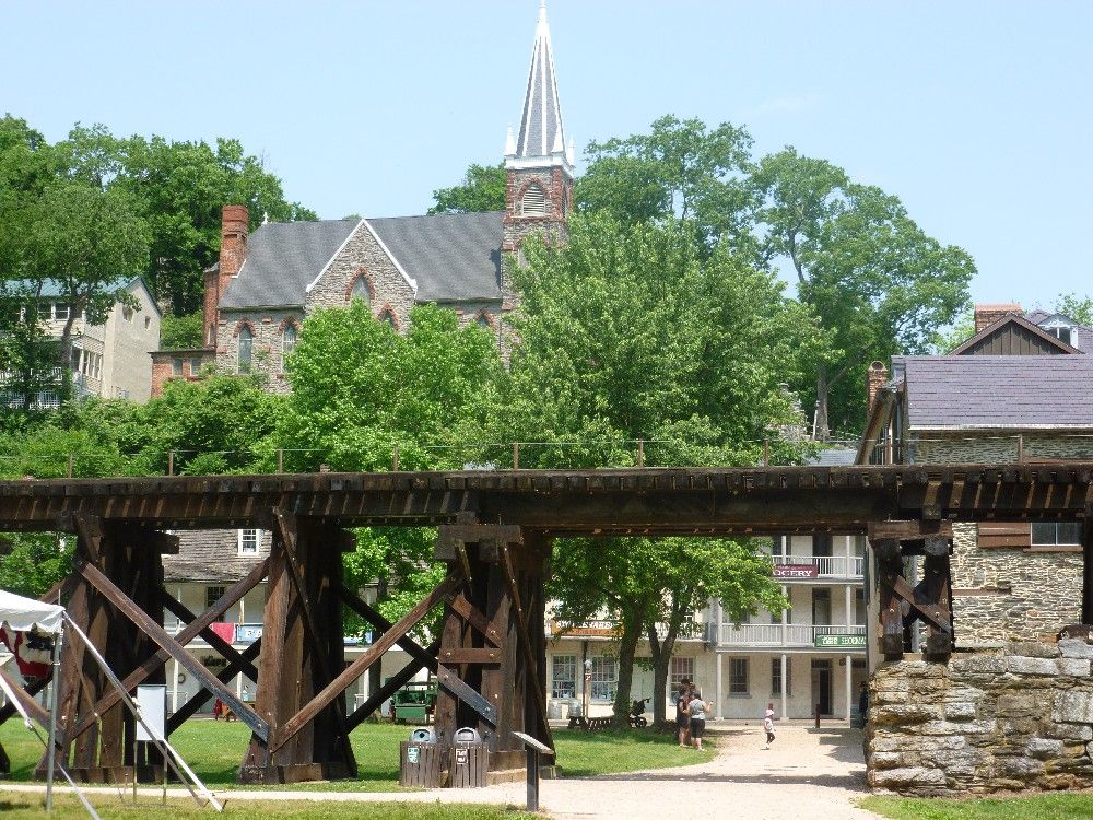
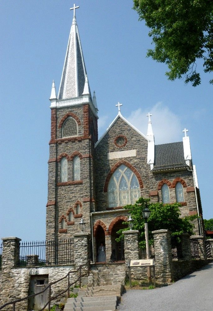
As I mentioned in Part 1, the Appalachian Trail runs through Harper's Ferry. Proceeding southward (and up some 18th-century stone stairs) from the railroad bridge over the Potomac, the trail runs right beside St. Peter's. Here's the front of St. Peter's, which is said to be haunted.
Further up the hill are the ruins of St. John's Episcopal Church. This church building was abandoned in 1895, when the congregation moved to another location within the city.

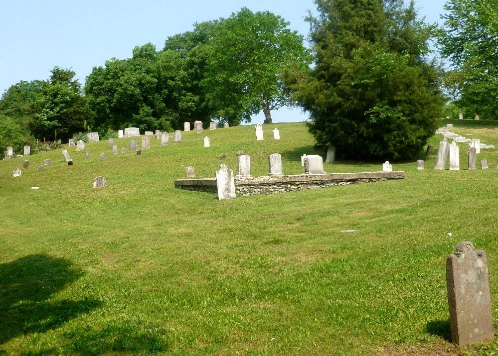
After the ruins of St. John's, the trail continues through a wooded area. A short side trail, which is mostly a stairway, leads up to Harper Cemetery.
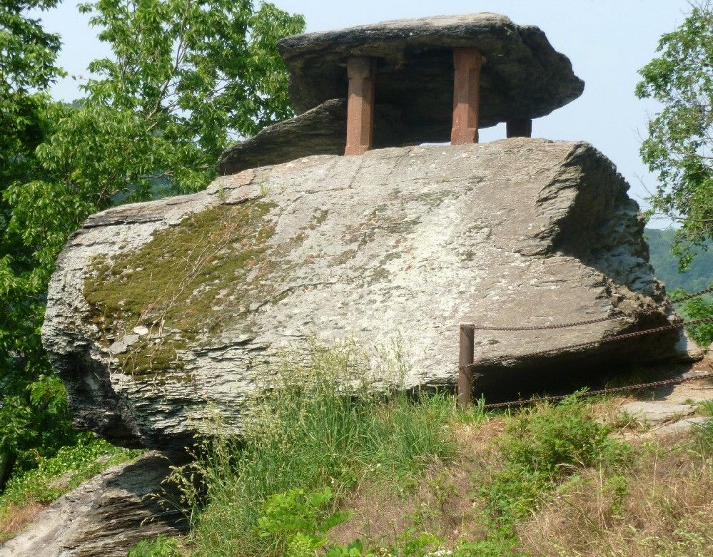
Not far from the St. John's ruins is Jefferson Rock, so named because Thomas Jefferson took in the view of the valley below while standing near it, on a visit to Harper's Ferry in 1783.
While researching Jefferson Rock, I stumbled upon a site that has pictures of Harper's Ferry from around 1970. The site's name is Moosic Mtn. Wild, which I find interesting since Moosic Mountain (which includes a nature preserve) and a small town named Moosic are located in northeastern Pennsylvania, about 250 miles to the north of Harper's Ferry.


0 comments:
Post a Comment